Estimated reading time: 9 minutes
Navigation satellites have become the backbone of modern-day positioning, navigation, and timing (PNT) services. From guiding aircraft across continents to directing a delivery driver to your doorstep, these satellites play a crucial role in our daily lives. Over the years, navigation satellite technology has evolved significantly, offering improved accuracy, reliability, and global coverage. Let’s dive into the top 5 navigation satellites of 2024 and explore how they are shaping the future of navigation.
Global navigation satellite system (GNSS) overview
What is GNSS?
The Global Navigation Satellite System (GNSS) refers to a constellation of satellites providing signals from space that transmit positioning and timing data to GNSS receivers. These receivers use this data to determine their location, speed, and time, regardless of weather conditions, anywhere on or near the Earth’s surface.
Key components of GNSS
- Satellites: The space segment consisting of a constellation of satellites.
- Ground Stations: The control segment monitoring and managing the satellite constellation.
- Receivers: The user segment, including devices that receive and decode the satellite signals.
Importance of GNSS in modern technology
GNSS underpins a vast array of applications, from navigation and mapping to precision agriculture and autonomous vehicles. Its accuracy and reliability are critical for various sectors, including aviation, maritime, military, and emergency services.
Top navigation satellites of 2024
Criteria for Selection
The top navigation satellites of 2024 are selected based on their technological advancements, global impact, and the extent of their enhancements over previous generations. Let’s take a closer look at these state-of-the-art satellites.
1. GPS III (USA)
Overview
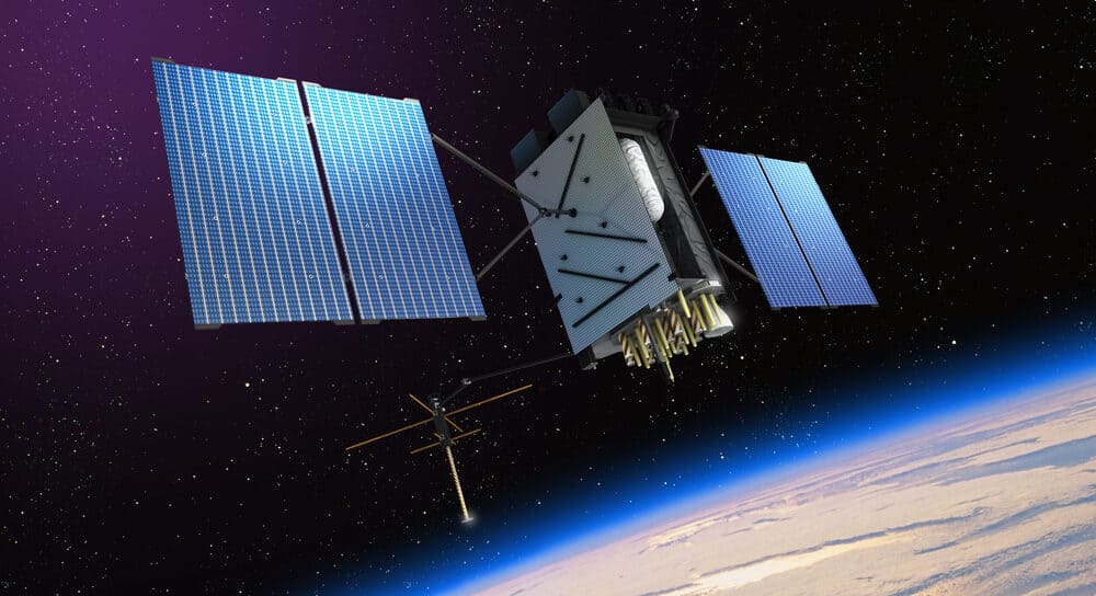
GPS III is the latest generation of the United States’ Global Positioning System, designed to provide enhanced performance and new capabilities.
Key Features
- Higher Accuracy: Provides three times better accuracy than its predecessors.
- Improved Anti-Jamming: Eight times more powerful anti-jamming capabilities.
- Longer Lifespan: Designed for a 15-year operational life, twice the lifespan of older models.
Advancements in GPS III
GPS III introduces a new L1C civil signal, which is compatible with other international GNSS signals, ensuring better interoperability. This satellite also features enhanced signal strength, improving reception in urban and challenging environments.
Impact on global navigation
GPS III enhances the reliability and precision of navigation services globally, supporting both military and civilian applications. Its advanced features make it a cornerstone in the GNSS ecosystem, benefiting users worldwide.
2. Galileo (Europe)
Overview
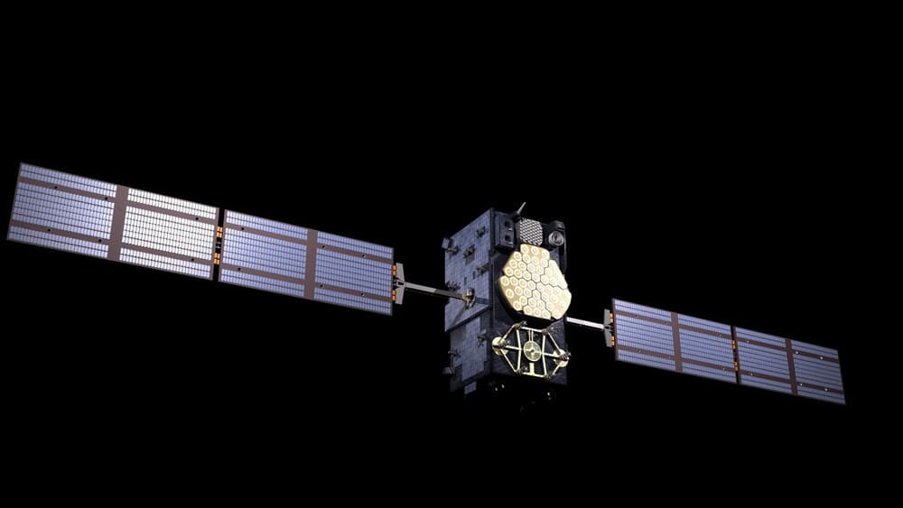
Galileo is Europe’s GNSS, providing high-precision positioning services worldwide, independent of other GNSS systems.
Key features
- High Precision: Offers accuracy down to one meter for public users.
- Encrypted Signals: Provides encrypted signals for governmental and commercial use.
- Open Service Navigation Message Authentication (OSNMA): Ensures the authenticity of signals, preventing spoofing.
Recent upgrades in galileo
Galileo has recently enhanced its signal robustness and timing accuracy, making it more resilient to interference. The system’s infrastructure has also been expanded, with additional satellites launched to improve coverage and service reliability.
Contribution to European Navigation Systems
Galileo significantly boosts Europe’s strategic autonomy in navigation, reducing reliance on non-European systems. Its high precision and secure signals support a wide range of applications, from public safety to scientific research.
3. BeiDou-3 (China)
Overview
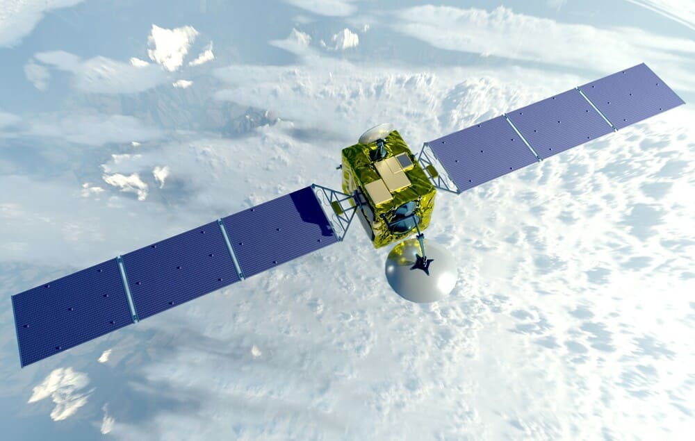
BeiDou-3 is the latest phase of China’s BeiDou Navigation Satellite System, offering global coverage and advanced services.
Key features
- Global Coverage: Provides worldwide positioning, navigation, and timing services.
- High Accuracy: Delivers meter-level accuracy for civilian use and even higher precision for authorized users.
- Short Message Communication: Allows users to send messages directly via the satellite system.
Technological innovations
BeiDou-3 integrates inter-satellite links, reducing dependency on ground stations for operations and enhancing system resilience. It also features multiple frequency bands, improving signal precision and reducing errors.
Role in Asian and global navigation
BeiDou-3 is pivotal for navigation in Asia, offering high-accuracy services critical for regional infrastructure and development projects. Its global reach makes it a key player in the international GNSS landscape, enhancing navigation capabilities worldwide.
4. GLONASS-K (Russia)
Overview

GLONASS-K represents the next generation of Russia’s GLONASS, aiming to improve navigation accuracy and reliability.
Key features
- Enhanced Precision: Provides better accuracy and improved signal strength.
- Longer Service Life: Designed for an extended operational life, reducing the need for frequent replacements.
- CDMA Signals: Uses Code Division Multiple Access signals for better interoperability with other GNSS systems.
Enhancements in GLONASS-K
GLONASS-K satellites introduce improved onboard atomic clocks, enhancing timing precision. They also feature advanced navigation payloads, supporting more robust and reliable services.
Glonass-K satellites have a ten-year guaranteed service life and multifunctionality. In addition to emitting navigation signals, they are capable of transmitting information from the emergency beacons of the International Space Search and Rescue System COSPAS-SARSAT.
Glonass-K satellites are made in the aerospace company for sptuniks and satellite equipment Reshetnev.
Significance for Russian navigation
GLONASS-K ensures that Russia maintains an independent and reliable navigation system, crucial for both civilian and military applications. Its improvements boost the overall performance of the GLONASS system, making it more competitive globally.
5. IRNSS/NavIC (India)
Overview
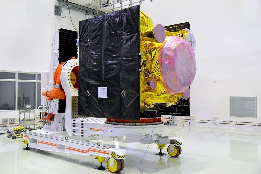
The Indian Regional Navigation Satellite System (IRNSS), also known as NavIC, provides accurate position information services to users in India and the surrounding region.
Key features
- Regional Focus: Specifically designed to cover India and its surroundings.
- High Accuracy: Offers accuracy better than 20 meters in the primary service area.
- Dual Frequency: Utilizes L5 and S-band frequencies for improved reliability and precision.
Recent developments in IRNSS/NavIC
NavIC has seen enhancements in signal robustness and coverage area. The system now supports expanded applications, including terrestrial, aerial, and marine navigation, as well as disaster management and vehicle tracking.
Benefits for Indian and Regional Navigation
NavIC’s regional focus provides India with strategic autonomy in navigation, reducing dependence on foreign systems. Its high accuracy and reliable services support a wide range of domestic and regional applications, fostering economic and technological growth.
Technological innovations in navigation satellites
Dual-frequency capability
Modern navigation satellites often use dual-frequency signals to enhance accuracy and reduce signal degradation caused by the Earth’s atmosphere.
Enhanced signal accuracy
Technological advancements have led to improved signal accuracy, enabling more precise positioning and navigation services, essential for applications like autonomous vehicles and precision agriculture.
Improved resilience to interference
Enhanced anti-jamming and anti-spoofing technologies make navigation satellites more resilient to interference, ensuring reliable services even in hostile environments.
Integration with IoT and smart devices
Navigation satellites now integrate seamlessly with the Internet of Things (IoT) and smart devices, providing critical data for applications ranging from smart cities to personal fitness tracking.
Challenges in satellite navigation
Space debris
The growing amount of space debris poses a significant threat to satellites, requiring robust strategies for collision avoidance and debris management.
Signal jamming and spoofing
Intentional signal jamming and spoofing can disrupt navigation services, necessitating the development of advanced countermeasures to protect satellite integrity.
High costs of satellite launch and maintenance
Launching and maintaining satellites involve substantial costs, demanding efficient management and innovative solutions to reduce expenses.
International collaboration and regulation
Global navigation requires international cooperation and regulation to ensure compatibility, interoperability, and shared benefits from satellite systems.
Future trends in satellite navigation
Miniaturization of satellites
Smaller, more cost-effective satellites, known as smallsats or nanosats, are revolutionizing the space industry, offering new opportunities for satellite navigation systems.
Quantum navigation technologies
Quantum navigation promises unprecedented accuracy and resilience, potentially transforming how we navigate and position ourselves.
AI and machine learning integration
AI and machine learning technologies are being integrated into navigation systems to enhance performance, predictability, and user experience.
Expansion of satellite constellations
Expanding satellite constellations ensures better coverage and reliability, supporting a broader range of applications and services.
Impact of navigation satellites on daily life
Personal navigation and transportation
Navigation satellites enable precise personal navigation, driving directions, and public transportation systems, making everyday travel more efficient and stress-free.
Emergency response and disaster management
Accurate positioning data from satellites is crucial for emergency response and disaster management, helping save lives and coordinate relief efforts effectively.
Agriculture and environmental monitoring
Satellites support precision agriculture and environmental monitoring, enhancing crop management, resource allocation, and environmental protection.
Military and defense applications
Military operations rely heavily on navigation satellites for accurate positioning, timing, and strategic planning, ensuring national security and defense capabilities.
Global cooperation in satellite navigation
International agreements and partnerships
Countries collaborate through international agreements and partnerships to share satellite data, technology, and best practices, enhancing global navigation services.
Sharing of data and technology
Sharing data and technology among nations fosters innovation and improves the overall effectiveness of global navigation systems.
Joint missions and research initiatives
Joint missions and research initiatives enable countries to pool resources and expertise, driving advancements in satellite navigation technologies.
Navigation satellites are indispensable in our modern world, offering critical services that touch every aspect of our lives. The top 5 navigation satellites of 2024—GPS III, Galileo, BeiDou-3, GLONASS-K, and IRNSS/NavIC—represent the pinnacle of this technology, each contributing uniquely to global navigation. As technology advances and new challenges arise, these satellites will continue to evolve, ensuring that we remain connected and accurately guided wherever we are.
FAQs
What makes GPS III different from previous GPS satellites?
GPS III offers three times better accuracy, eight times improved anti-jamming capabilities, and a longer operational life compared to previous GPS satellites.
How does Galileo enhance navigation in Europe?
Galileo provides high-precision positioning, encrypted signals, and robust signal authentication, enhancing navigation services across Europe.
What are the unique features of BeiDou-3?
BeiDou-3 offers global coverage, high accuracy, short message communication capabilities, and advanced inter-satellite links.
How does GLONASS-K benefit Russian navigation?
GLONASS-K provides enhanced precision, longer service life, and improved interoperability with other GNSS systems, bolstering Russian navigation capabilities.
What are the advantages of IRNSS/NavIC for India?
IRNSS/NavIC offers high accuracy, regional focus, and dual-frequency signals, providing reliable navigation services specifically tailored for India and its surroundings.


